Mussel Bed Mapping Extravaganza
8 AM–9 AM | Gulf of Maine | PublicMeet GMRI and community partners in the field to help map mussel beds. Try to attend our Webinar: Intro to Mussel Bed Mapping before!
Show us your mussels!
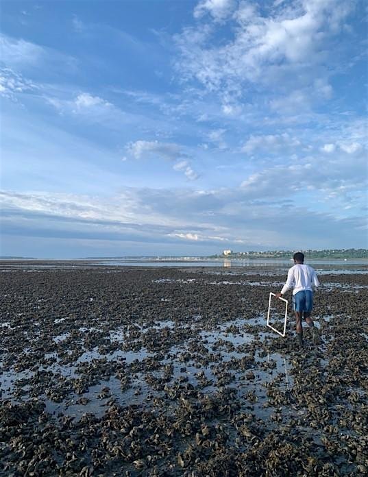
Join GMRI and several partner organizations for a mussel bed mapping extravaganza event that spans the coast of Maine and New Hampshire! Help us observe where mussels are (and importantly, where they aren't) during an extreme low tide on June 18. While in the field collecting observations, you'll also be learning about blue mussel beds, local ecosystems, and ongoing research. The data you collect will be put to use in our Mussel Bed Mapping Community Science Project.
Before joining us in person, we encourage you to attend our webinar, Intro to Mussel Bed Mapping, on Thursday, June 11 at 12 PM to learn about the basics of blue mussels, the community science project your data will be contributing to, and how to participate.
In-person group meet-ups will be happening at multiple sites across Southern Maine and New Hampshire — the host sites are listed below. You can also participate independently at a different site that is local to you! When registering, please select where you plan to make observations.
Please note: Fieldwork will take place in the intertidal zone, so be prepared to walk along mudflats to collect data.
Host sites for fieldwork include:
- Hamilton Audubon Sanctuary, West Bath, ME
- Harpwswell Town Office, Harpswell, ME hosted by Quahog Bay Conservancy
- Bowdoin College Schiller Coastal Studies Center, Orr's Island, ME
- Chebeague Island, ME
- Littlejohn Island Preserve, Yarmouth, ME hosted by Royal River Conservation Trust
- East End Beach, Portland, ME hosted by Friends of Casco Bay
- Biddeford Pool Boat Launch, Biddeford, ME
- Odiorne State Park/ Seacoast Science Center, Rye, NH
Project partners for this day of Mussel Bed Mapping include: Quahog Bay Conservancy, Bowdoin College Schiller Coastal Studies Center, Royal River Conservation Trust, Friends of Casco Bay, and Seacoast Science Center.